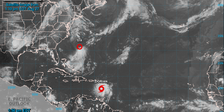
At 11:00 am today, the center of Tropical Storm Dorian was located near latitude 14.2 North, longitude 61.8 West, or about 285 miles south of St. Maarten. Dorian is moving toward the west-northwest near 13 mph (20 km/h), and this motion is expected to continue through tonight, followed by a turn toward the northwest on Wednesday.
On the forecast track, the center of Dorian will move across the eastern and northeastern Caribbean Sea during the next few days, passing near or south of Puerto Rico on Wednesday.
Maximum sustained winds remain near 50 mph (85 km/h) with higher gusts. Slow strengthening is forecast during the next 48 hours, and Dorian is forecast to be near hurricane strength when it moves close to Puerto Rico and eastern Hispaniola.
The estimated minimum central pressure is 1005 mb (29.68 inches).
The center of Tropical Storm Dorian is projected to pass about 175 miles southwest of St. Maarten early Wednesday, and thus poses no significant threat. However, showers, thunderstorms and gusty winds are possible from the outer bands.
Meteorological Department St. Maarten will continue to monitor Tropical Storm Dorian and issue special weather bulletins.


